Goathland standing stones
Here's a long run around the moors above Goathland in the North York Moors. Along the way, it takes in the standing stones at Simon Howe and on Wheeldale Moor, including the locally-famous Blue Man i' th' Moss; old megalithic structures in Cropton Forest, and enough high, boggy moorland to satisfy even the clartiest cross-country runner.
I start midmorning in Goathland. Plenty of parking in town if you need it. Easy going to get the blood pumping along the old Whitby & Pickering railway, opened in 1836 and operated at first entirely by horses. Long closed and superseded by the "Deviation Line" now operated by the North York Moors Railway, the old route is an easygoing walking path, popular with locals on brisk Saturday mornings. I should know.
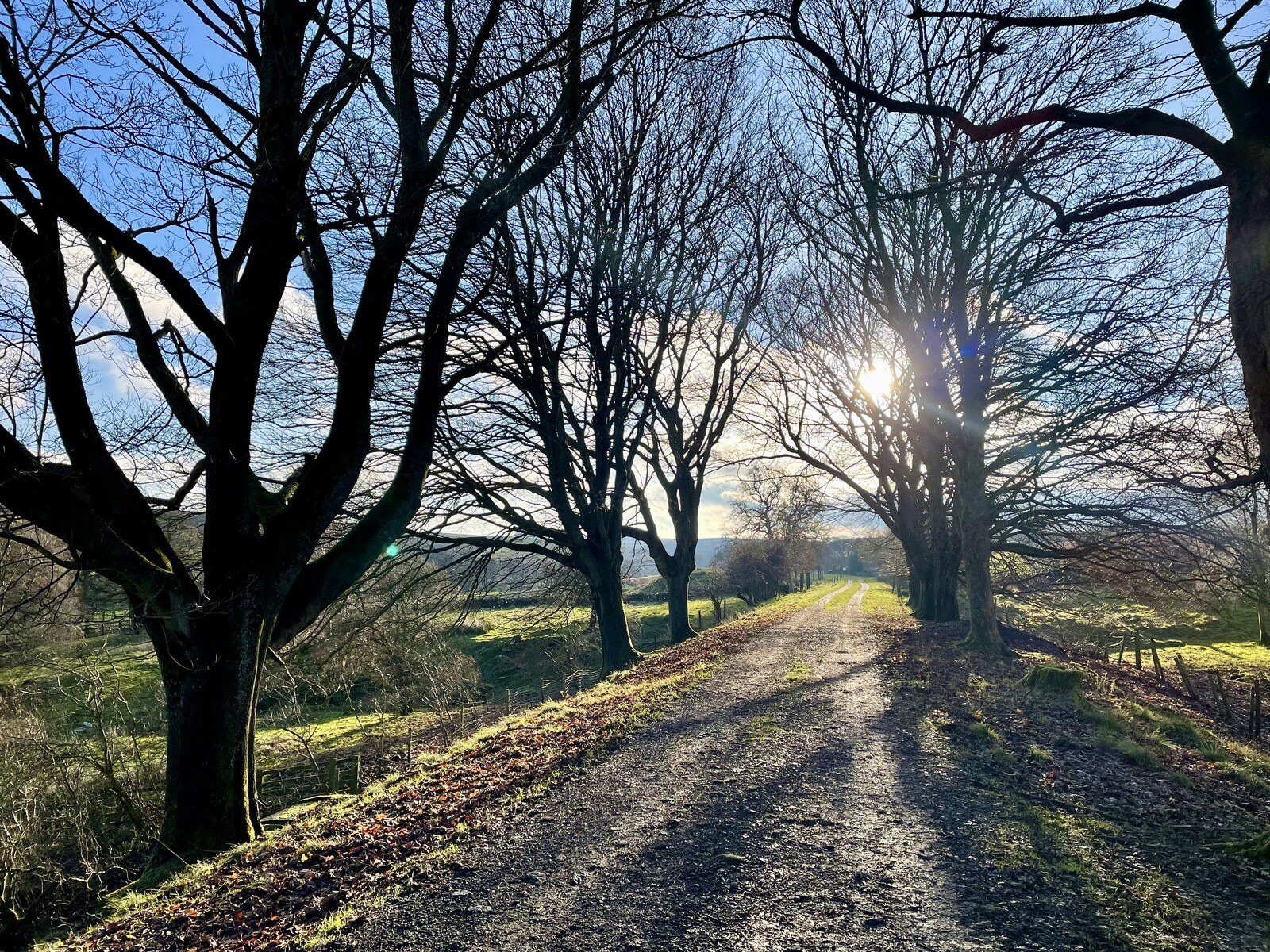
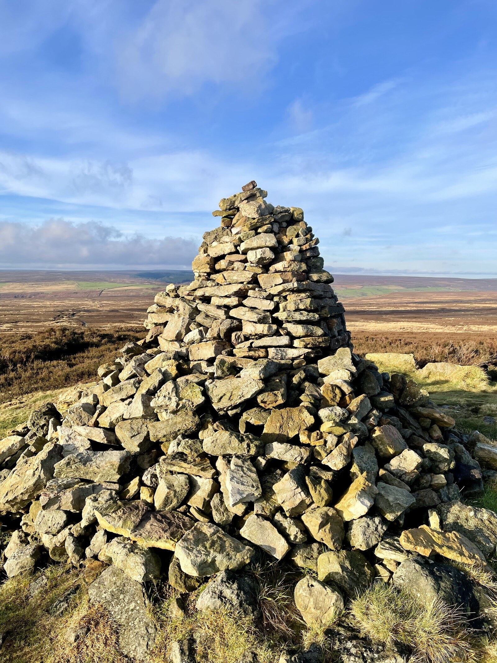
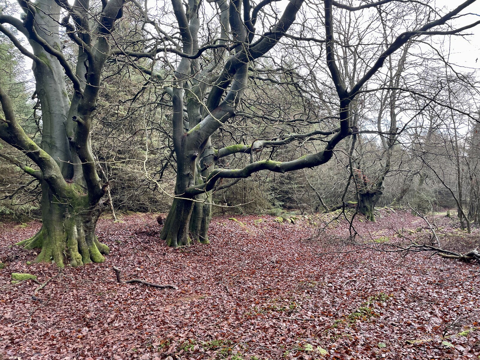
Just past Sadler House I cut back on myself for a bit of road running. The verge here is passable and covered in short turf, and the road is sparsely traveled. I shortly leave the road on an overgrown path up towards Simon Howe. I can't stress enough how difficult the path is to follow, here; at one point I lose it and have to trudge knee-deep through a bog; at another point I miss a step and fall headlong into the rushing Moss Dike, swollen after weeks of rain, soaking me up to my chest. I spot the massive cairn atop Simon Howe from a little ways away and make directly for it. There are a few standing stones in a row leading away from the cairn. These stones have stood here for thousands of years, but I snap a couple of quick pix and move on.
The path down the back of Simon Howe Rigg is easier to follow, the tall dark pines of the managed forest growing before me. I scoot downhill, over a footbridge, through a gate, and skirt a row of trees before emerging on a forest track. Just up the hill from me is, apparently, a ruined farm, but I only get as far as the gateposts before I'm turned back by mud and saturated lawns. Down the forest track I go.
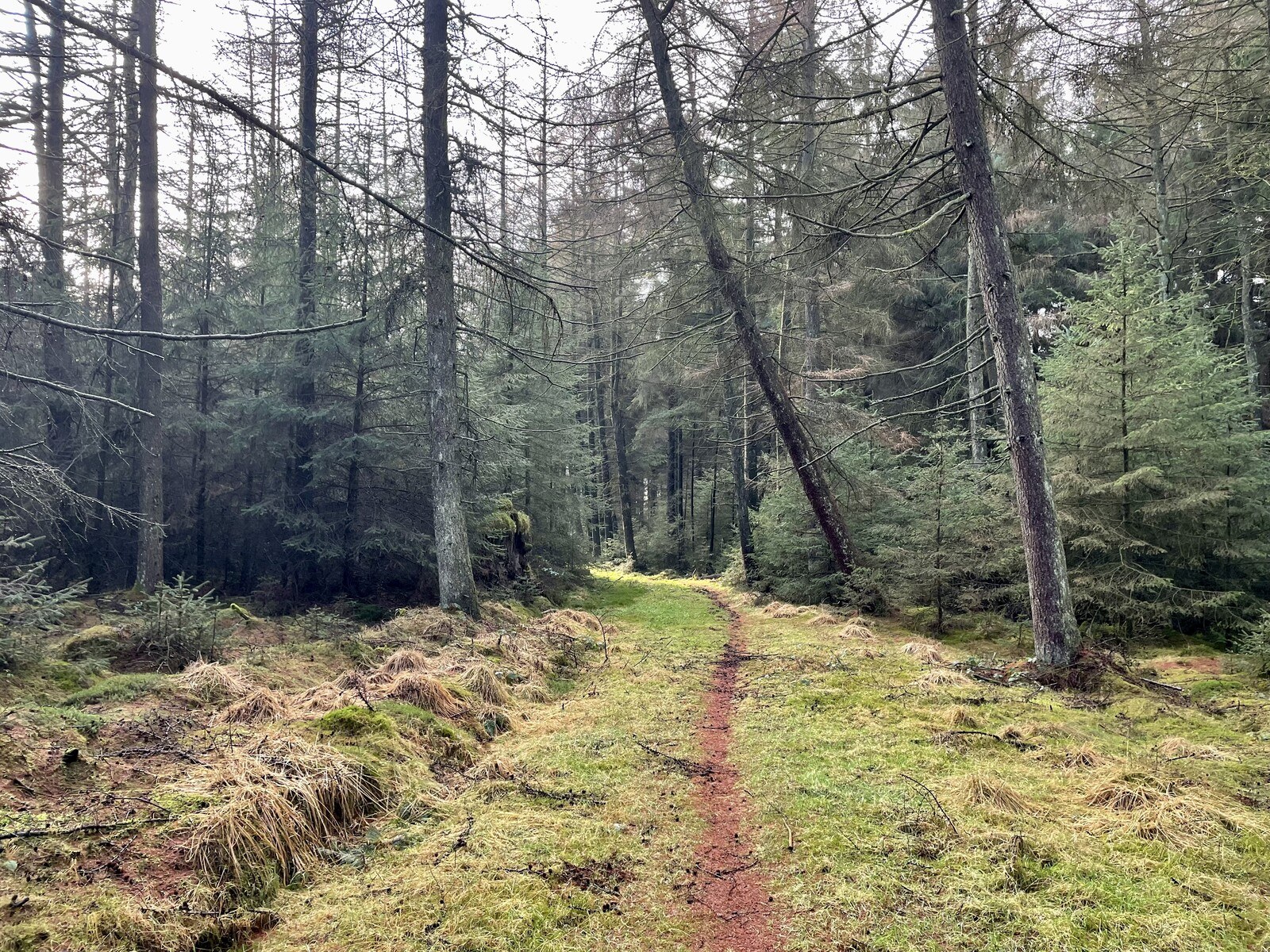
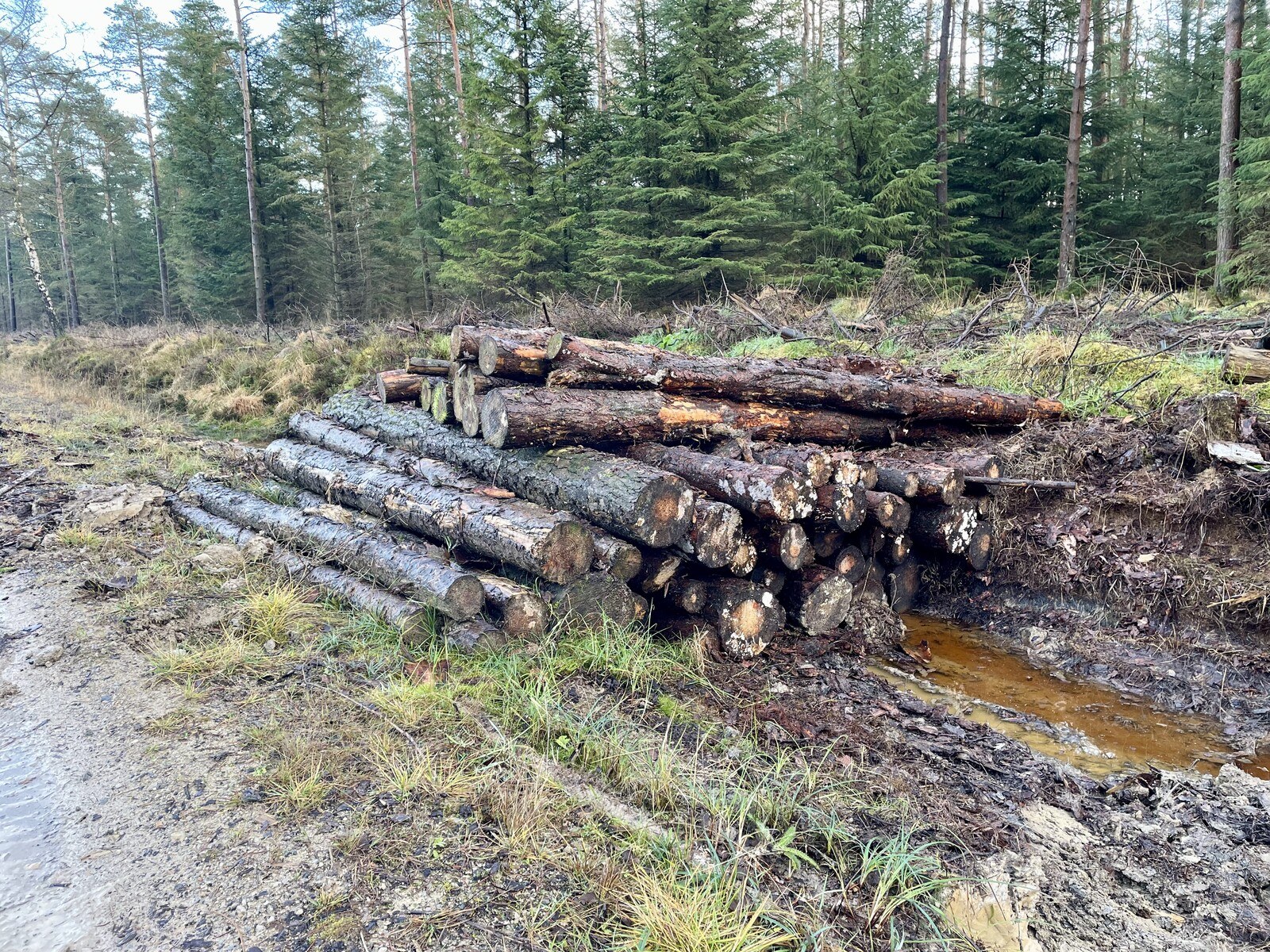
The forest track through here is very well-groomed, but the forest gives off a somehow otherworldly vibe. I'm haunted by the sense that no one has been here for a very long time—the trees are undisturbed and the characteristic piles of timber by the roadside are missing. Now and again I spot a couple of rotting logs in the ditches. The forestry track is labeled "Blawath Road" on the OS maps, but I can't find anything significant enough about it to warrant a proper name.
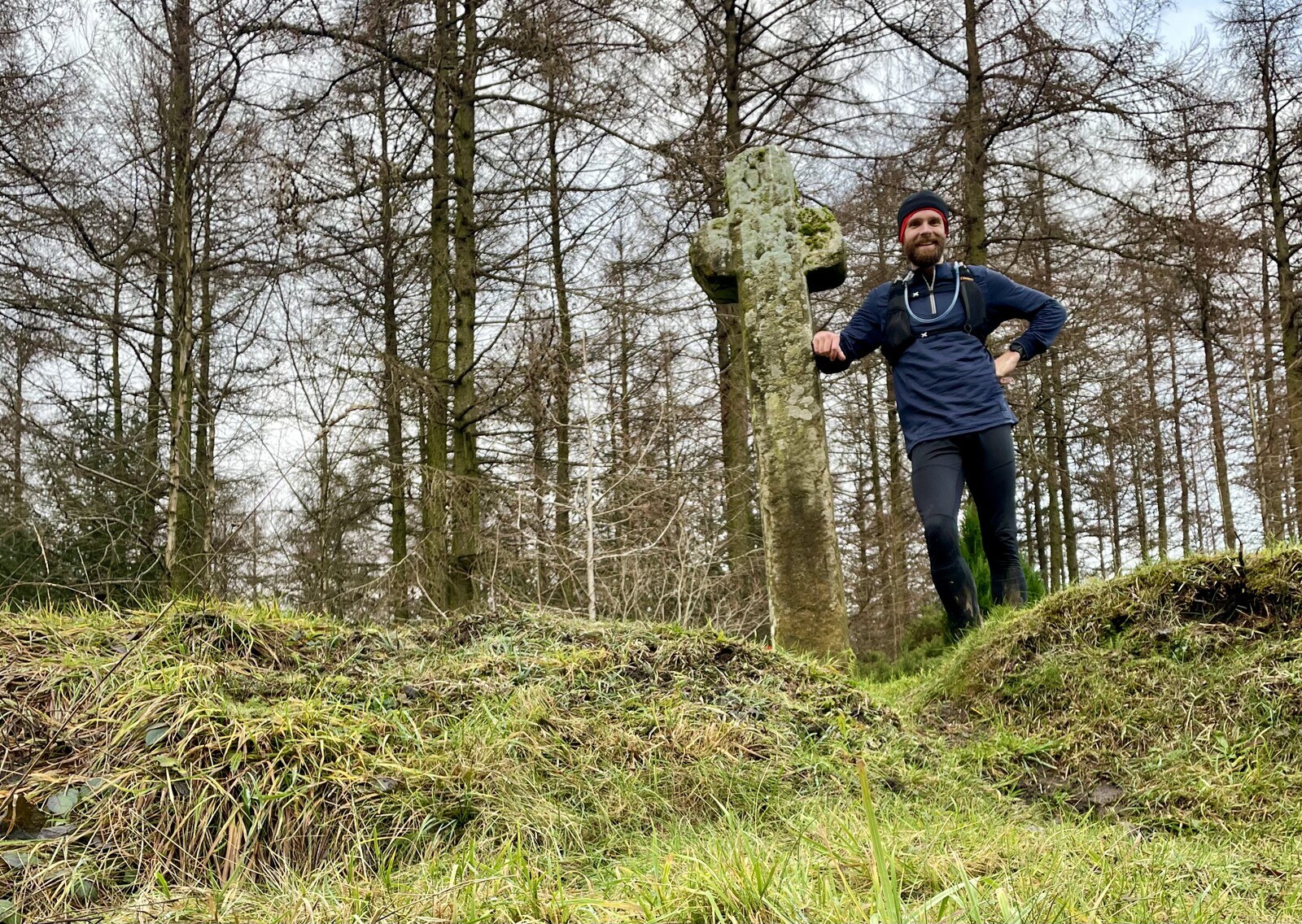
Just before joining the paved road running from Grosmont over the moor to Pickering, I come to Mauley Cross on an embankment by the side of the track. The cross is sandstone and was erected in the Dark Ages alongside the nearby Roman road. In the top is a small depression where coins were left for the poor, like on Ralph Cross on Blakey Ridge. Pictures online made Mauley Cross look much bigger than it actually is; what it lacks in stature it certainly makes up for in age.
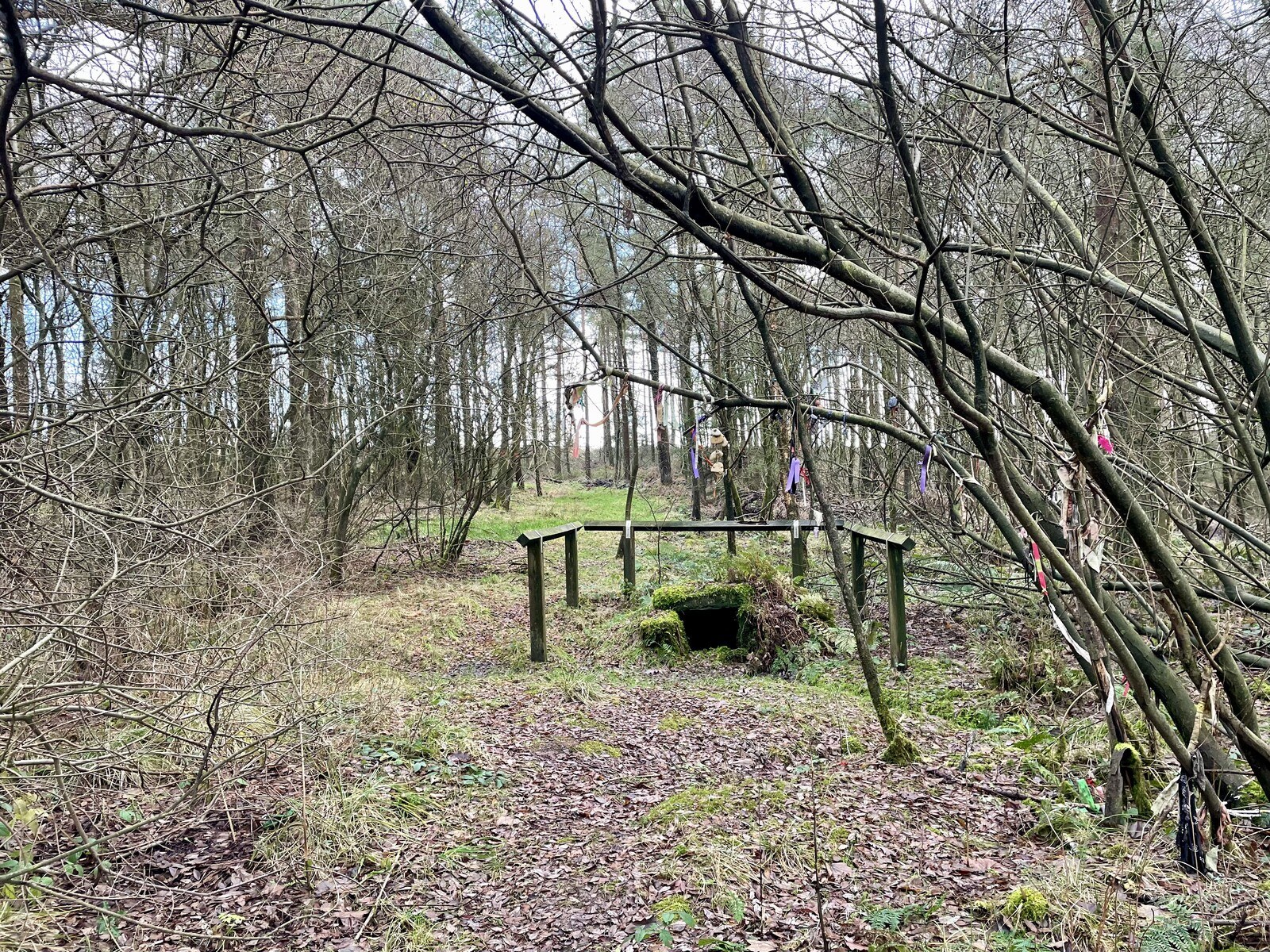
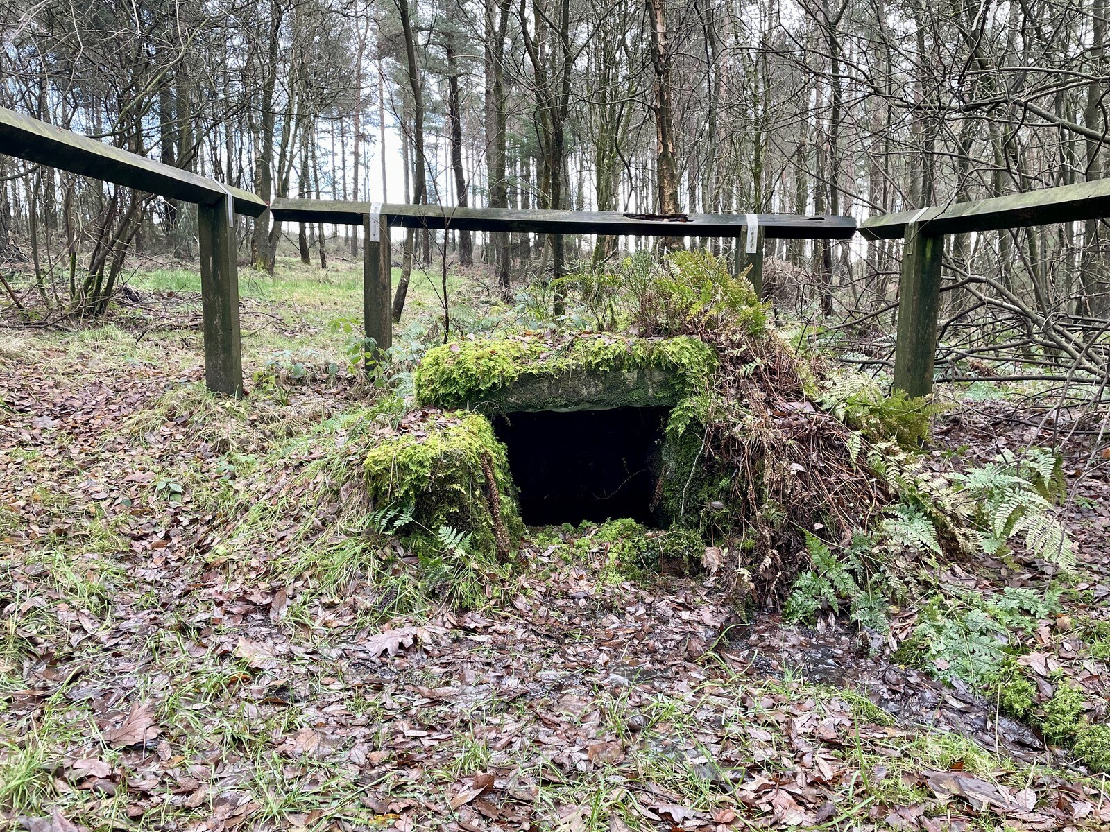
Joining the road and clomping down the hill, I arrive shortly at the Old Wives Well, a natural spring covered by a trio of old flagstones from time immemorial. Megalithic Portal reckons it's "of unknown date", but speculates that its proximity to the now-paved Roman road hints at its minimum antiquity. There's a short trail leading from the road down to the well itself, overhung with scraggly trees and lined with uneven turf. The atmosphere around the well is... unsettling, somehow. Maybe I'm winding myself up. There are bells and ribbons strung in the trees around the well, and they chime distantly in the rising wind. I take a few pictures, half expecting to see orbs or something, before hightailing it outta there.
A short section of road running is abruptly terminated by a hard right across a field and back into the forest. The trail skirts the treeline; deep in the timber is dark and cold and foreboding. Thick with gorse and brambles through here; the trees press closer still. I'm feeling a bit spooked from the Well and it strikes me that running through here at night would be, in a word, harrowing. I pass an abandoned home and plunge back into the overgrown forest; just past here is an open clearing with an ancient tumulus, a ruined farmstead, and weird earthworks—field boundaries, maybe with long-collapsed stone walls underneath. From here I follow what seems to be, to me at least, a very old road. It lets out onto more conventional managed woodland tracks, which I follow north for a ways. The uneasy feeling morphs, gradually, into boredom.
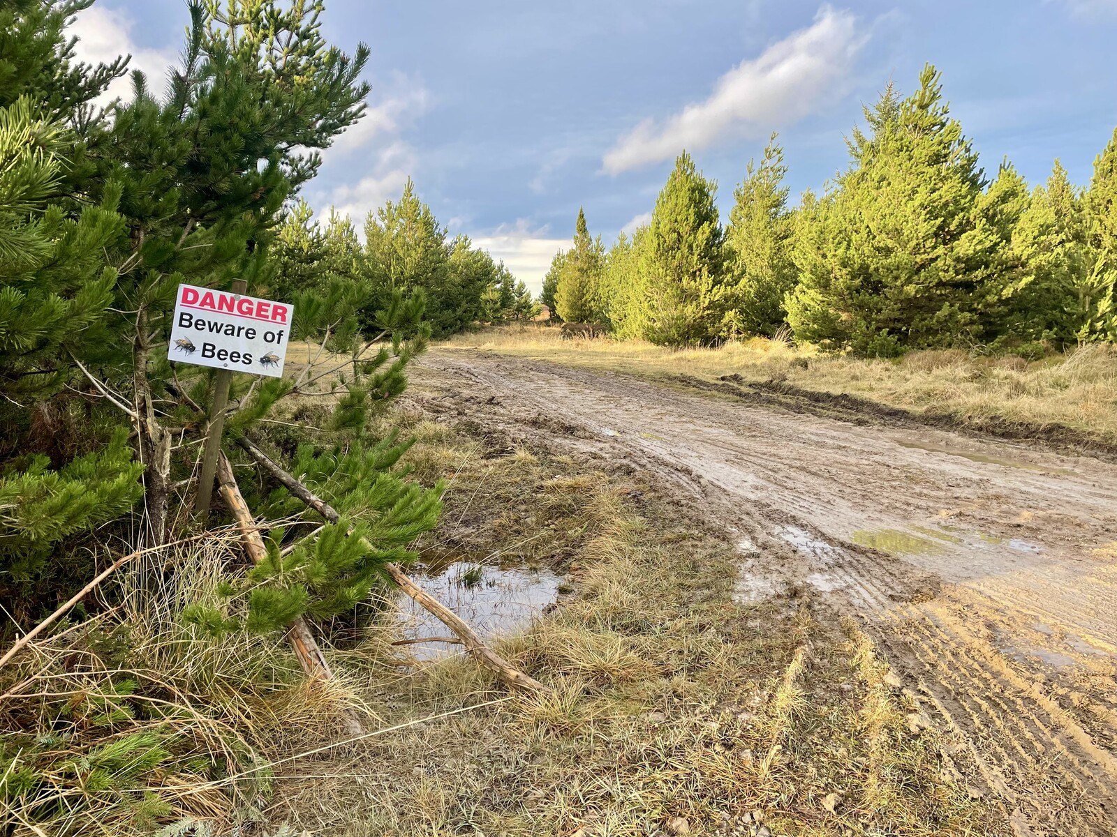
The woodland track deadends at the bottom of Black Moor Rigg, a big heathery moorside littered with boundary stones but nary a trail in sight. A sign nearby warns, Danger Beware of bees. I don't see, or hear, any bees: it's December, which is probably not bee season. I hop the fence and strike off across the moor.
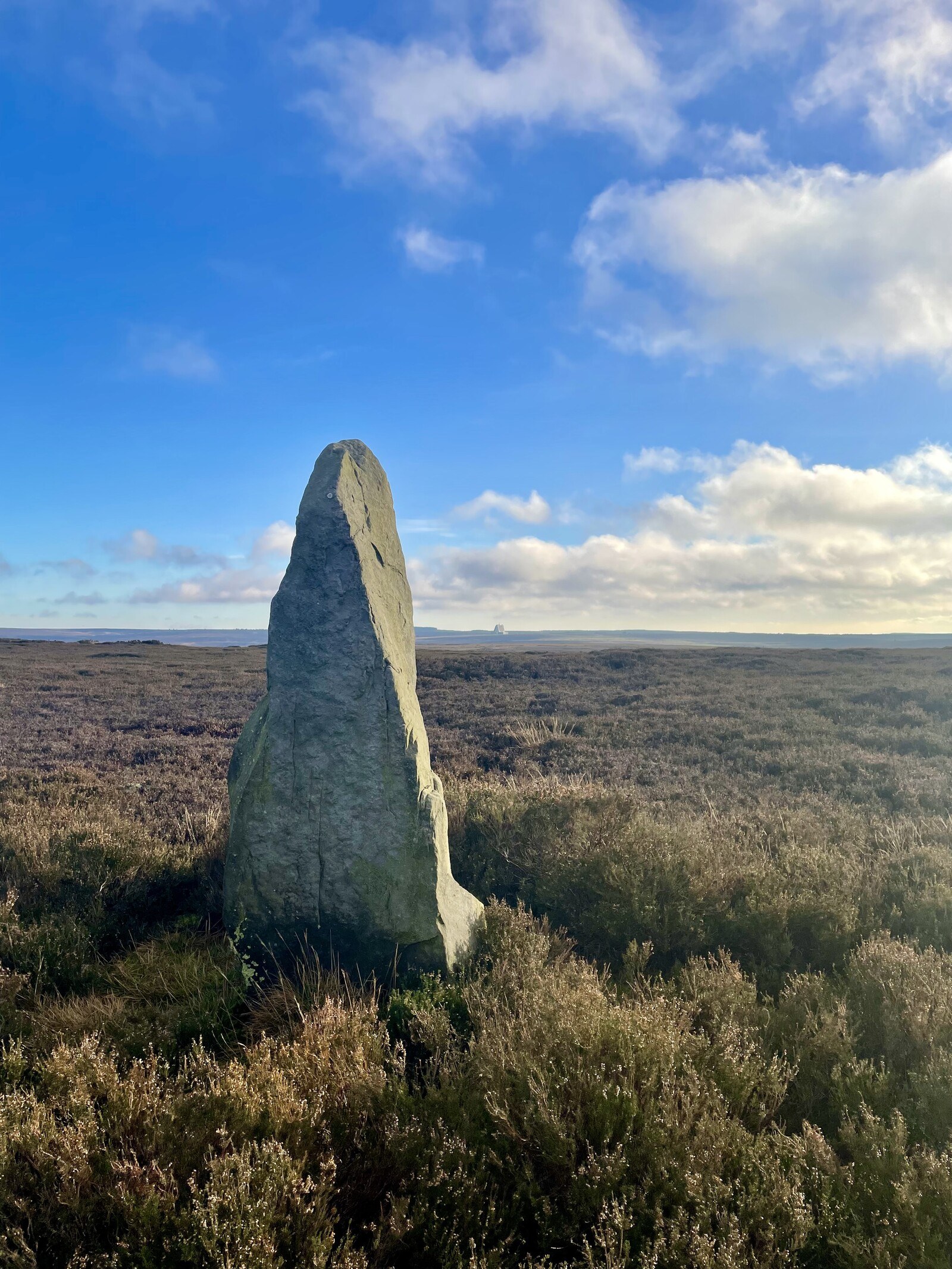
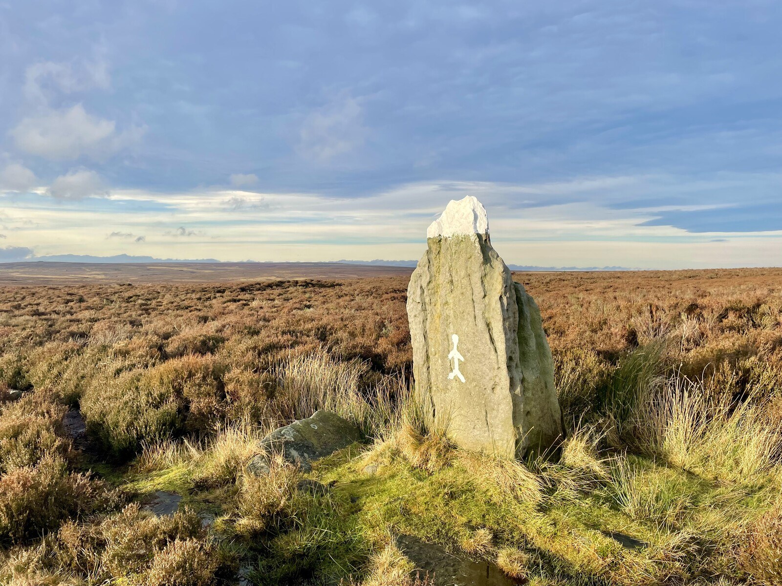
As my goal is the Blue Man i' th' Moss standing stone, I make my way as directly up the moor as I can; aiming first for a tree about halfway up but realising a bit too late that it's well to the right of where I'm meant to go. In the distance I spot a row of standing stones painted white on top—probably old estate boundary stones, rather than neolithic ones—and use those to navigate in to the Blue Man. The heather's shorter at the top of the moor than at the bottom, which makes the going easier as I get closer.
The Blue Man i' th' Moss is somewhat diminished by the more imposing Wheeldale Howe just to the northeast of it, topped as it is with a fun modern cairn, but the Blue Man's stature and considerable weathering give it an austere presence. There's a modern graffito of a stick figure on the front, and the enterprising fellow that painted white caps on the other boundary stones has painted the Blue Man as well, which I'm distantly miffed at. The blue paint that gives the standing stone its name is all but totally eroded away; there is also barely any moss in the vicinity.
I pause to take a couple of (hopefully) artistic-looking shots in the day's last light, then move off across the moor. The path has been pretty much totally submerged by the last month's rains, so I'm forced back into the heather for some slow going. I spot a few boundary stones marked with "E / 1850" on the way up to the Egton-Rosedale road, at which I turn right for a long stint of road running.
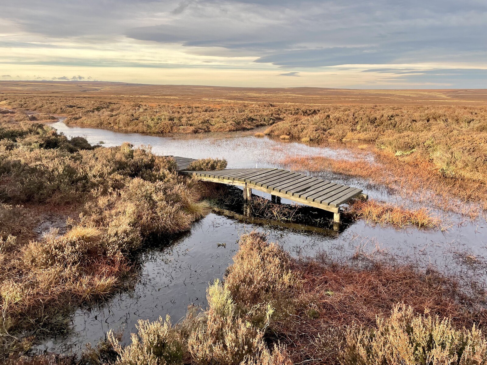
Not much to say about this part of the run; the dry road is a blessing for my soggy feet but a curse for my sore knees. I try to stick to the soft roadside turf where I can, but I'm averse to clomping through heather where it encroaches on the verge. My feet are just about dry when I cast off across Egton High Moor and promptly soak them through again. A simple gravel track takes me across the moor and gently downhill. I cross the Wheeldale Road at a section marked on maps as Roman, but it's of dubious interest nowadays.
Down, down, down: down the moor, across a road, then down a steep rut in an old wood, down past a cottage and down along a couple of becks, crossing what seems like six or seven footbridges in a couple hundred metres, down to the old Whitby & Pickering Railway for an easy end to the run. I see walkers with dogs, teenagers who go silent as I pass, sheep and cows sharing a field once occupied by a massive ironworks. I pass a bend in the railway with a plaque indicating where the ancient bridleway meanders through the wood on the far bank. I'm nearly back in Goathland when I arrive at the bottom of the Beckhole Incline.
The Incline, opened to rail service in 1836, once served as the only way to get railway wagons up onto the high moor where the town of Goathland is. We're talking: before the age of steam engines. A big water tank fitted with wheels operated as the counterweight to pull the wagons to the top of the 1.5-kilometre incline before a stationary steam winding engine was installed at the bank top to pull the wagons up by sheer mechanical force. The incline was made derelict by the creation of the deviation route of a much shallower grade, operable by standard steam locomotives, in 1865. Nowadays, the rails are long gone, but the incline is a popular walking path—or, in my case, running path: for I intend to run the whole way up the 1-in-12 incline.
And run I do, chugging my way all the way to the top, past the old ticket office, past the public toilets and car park, past the pub from that one television program, to the village green, where Sam and Ghyll are waiting for me.
Next
Catching up on some reading, TIME is making me think of the vast quantities of plastic currently being sold on wish dot com.
Previous