Mokoto-yama (藻琴山)
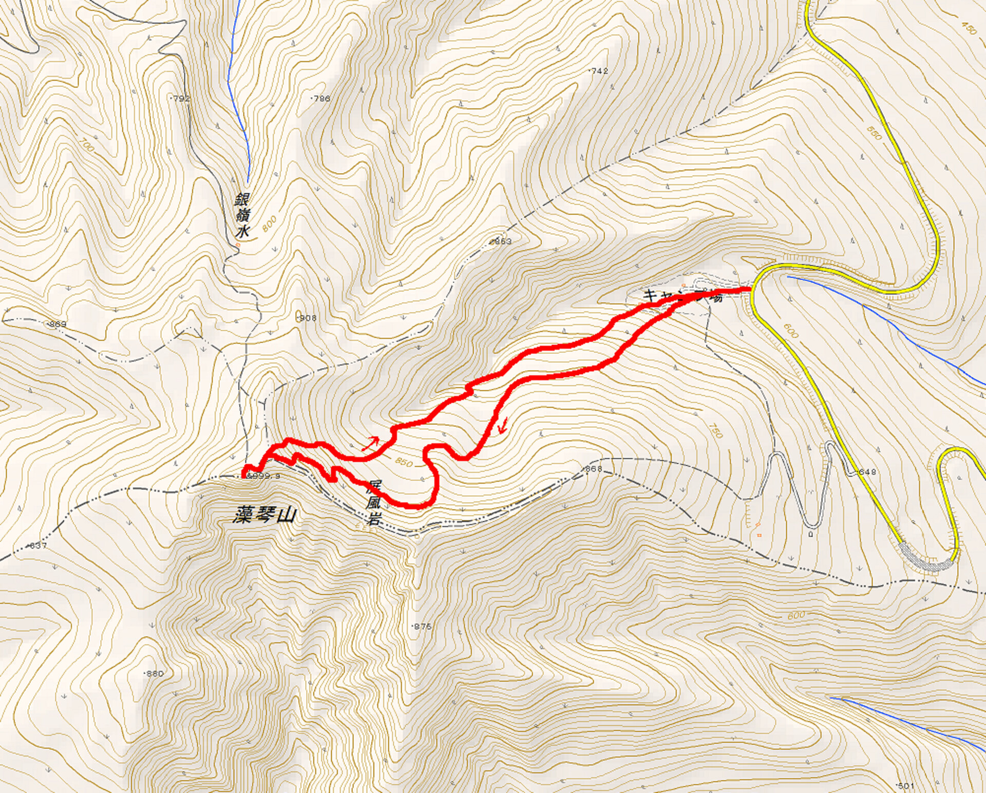
If there’s one mountain out east that everyone has climbed in the wintertime, it’s Mokoto-yama (藻琴山, 1000 m). Well, okay, maybe it’s Nikoro-yama (仁頃山, 829 m), but Mokoto-yama is the more attractive one. It towers over the broad Lake Kussharo and features relatively easy access and a short climb to the summit from Highland Koshimizu Campground (ハイランド小清水キャンプ場). I decided that I needed to go check it out, so I woke up one morning before the sun came up and headed for the trailhead.
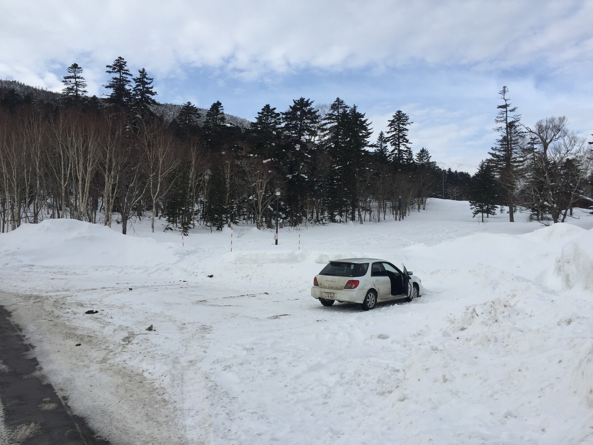
When I got there, the sun still wasn’t up but the sky was reasonably light. A couple of snowplows were still patrolling the road, escorted by tired-looking guys in Nissan X-Trails. There’s a small parking lot at the trailhead with room for maybe 10 cars (strategically parked) but I was the only one there. As I got ready an X-Trail pulled up nearby and the guy put his seat back and started smoking.
There’s a small sign at the trailhead indicating that, as the mountain has become more popular, so too have avalanches become more frequent. The warning, which included all sorts of aggressive precaution (never go into the backcountry alone, or, avalanches are quite common around here), sort of spooked me, alone in the early morning. But I had come this far, so I crossed the snowbound campsite beyond the sign and headed up into the evergreens on the slope to my left.
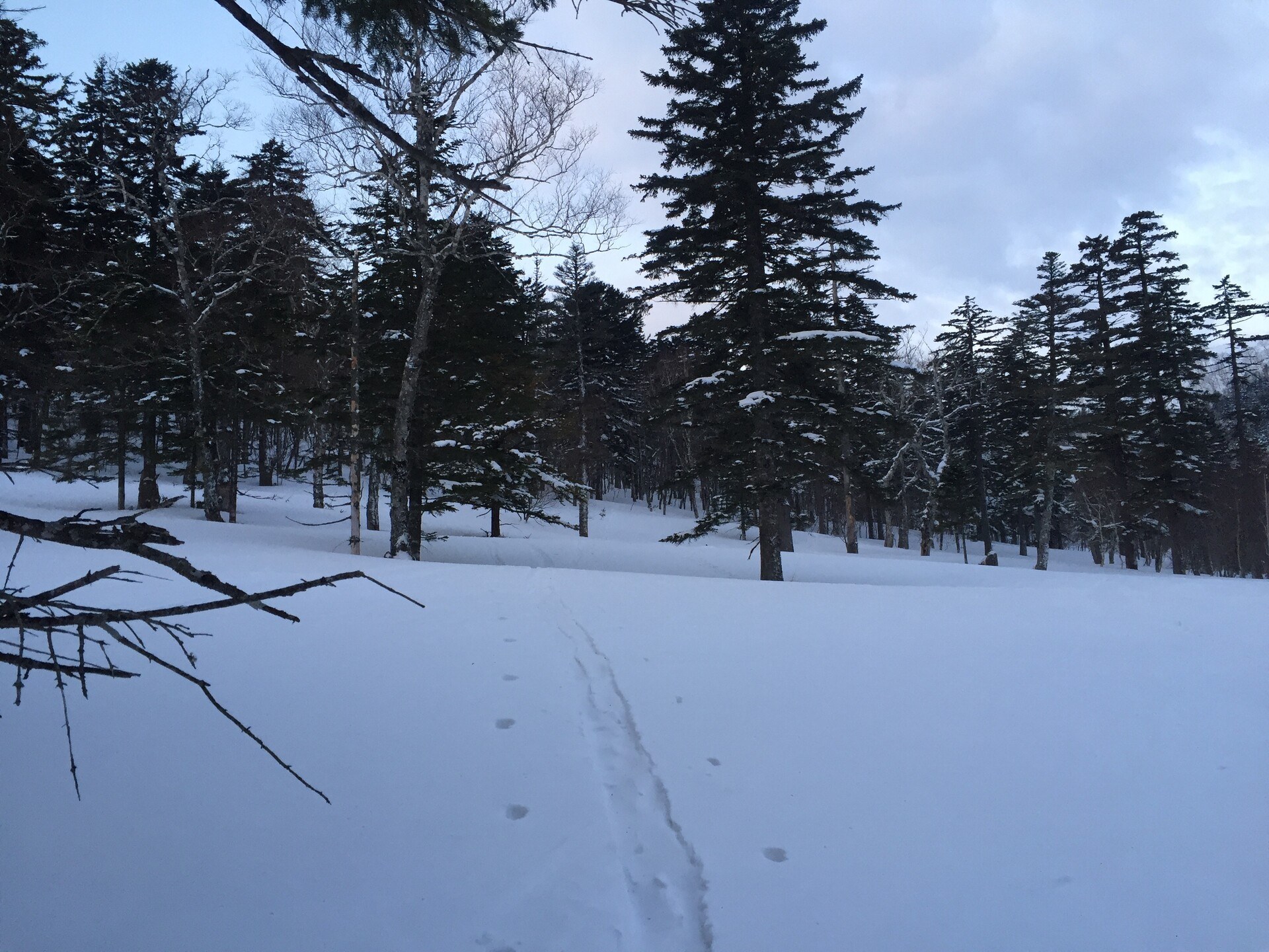
In the campsite there were a good number of old tracks, maybe from a day or two prior, but as I headed into the trees they seemed to thin out. I considered switching back and trying to mount the top of the ridge—which would have been advisable in avalanche territory—but the slope didn’t look too bad and I was following someone’s tracks, so I continued.
Eventually I traversed a shallow gully and came to a low ridge, where the snow was windblown and crusty and the tracks I had been following disappeared. I decided to turn my skis upwards and start climbing the apex of the low ridge; partway up I rediscovered the tracks I had left, only to find that the maker had given up. The snow was disturbed and there were ski boot tracks and a bit of a hole where the skier must have removed their skins to head back down. At any rate, I continued.
The trees thinned and I found myself near the top of the big main valley. Across from me the slope was almost totally clear of trees and crisscrossed with ski tracks. Above me, just below the ridge at the top of the valley, the trees were dense and looked impassable, so I made a careful traverse northward, towards the summit. The slope here was crusty and windblown and tough to navigate in skins, but it was better than the avalanche-prone alternative of a wind-loaded gully. Maybe I was just still spooked from the sign.
I finally had to mount the ridge or else face backtracking, so I started pulling myself up between the trees just below the ridgeline. It was hard going on skis; it might have just been smarter to take them off and climb through on foot. The snow was certainly crusty enough to get a good foothold in plastic ski boots. If I were to climb again I think I would make an effort to mount the top of the ridgeline as early as possible, to avoid having to clamber through the trees just below the ridge.
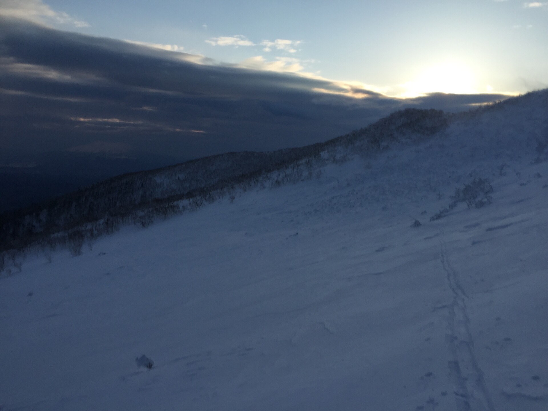
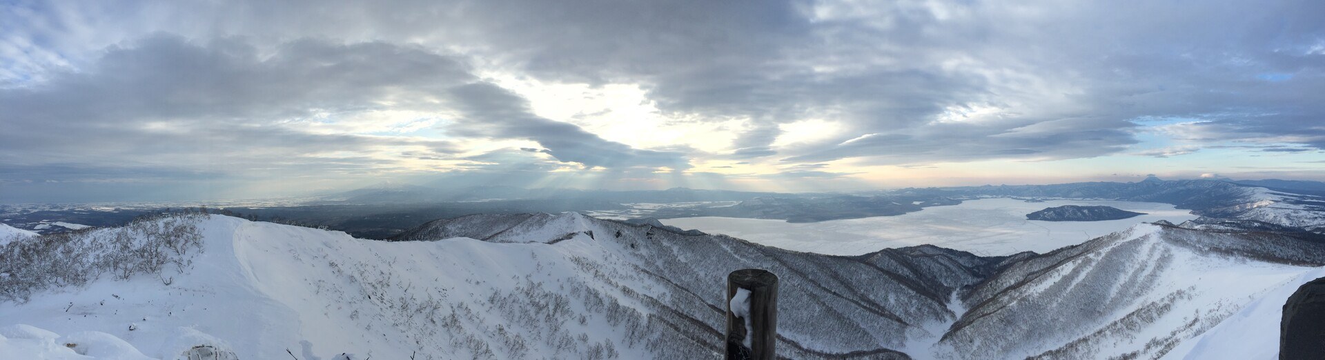
By and by I made it onto the ridge, though, facing down a huge valley that swept down to Lake Kussharo below. The lake was crisscrossed with snowmobile tracks and footprints, which looked pretty neat from altitude. The wind that had blown the slope I had traversed had also formed a huge cornice, which I stayed very very clear of. The wind had turned around since then, though, and with a vengeance, so I decided to head up the ridgeline with haste.
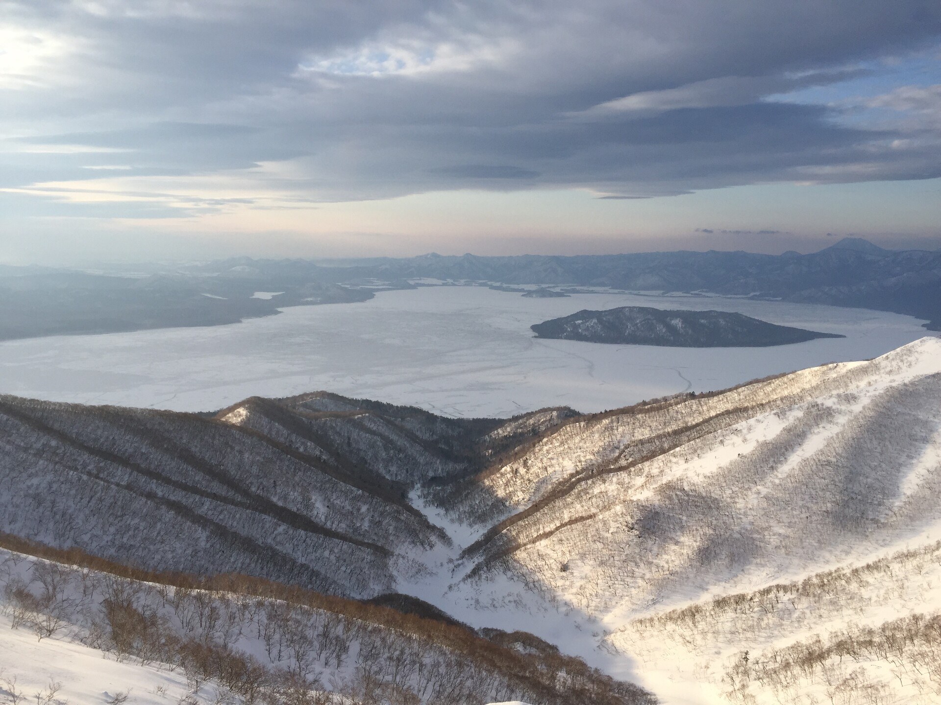
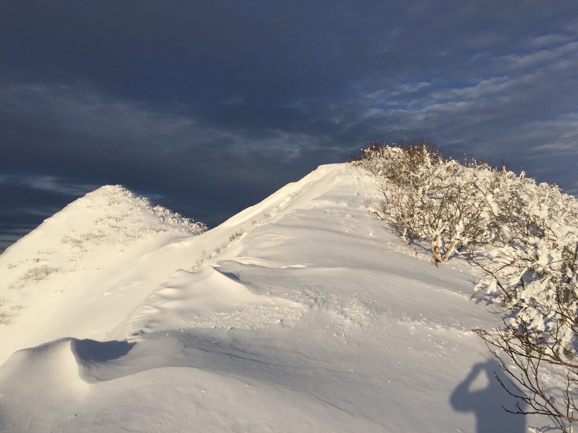
Near the summit there’s a bit of a saddle, and the wind was blowing through here something mighty. The climb to the summit itself was pretty steep so I took off my skis and tucked them behind a little rise so they wouldn’t blow off and climbed up to the summit in my boots. The sun was sitting off to the southeast and it was lighting up Oakan-dake and Meakan-dake to the south; to the north I could see the sharp peaks of Shari-dake and Unabetsu-dake’s broad flanks behind it.
On the way down I stashed my climbing skins and made my way back over to where I climbed. The skiing was crusty near the ridge but there was a sweet little stash about halfway down, where I laid down some S’s and felt like a real pro. Before I knew it though, I was back in the trees and with the sun coming up temperatures had risen above zero. The snow on the bottom half of the mountain was sticky and wet and I had to push myself out. With wax I might have been fine but I haven’t waxed my skis in a little while, and the snow was so wet that it was actually sticking to the bottomof the skis. Which I had never seen before but there ya have it.
Back at the car I packed up all my stuff as the first of the day’s climbers were getting there.
Highland Koshimizu Campsite: 6:18 -> top of the main valley: 7:11 -> summit: 7:41 -> heading down: 8:02 -> Highland Koshimizu Campsite: 8:19
climbing time: 1 hour, 23 minutes / descending time: 17 minutes
Previous
Patagonia Nano-Air Hoody Review
The things I like about my favourite purple jacket, and the things that I don't.