Okirika-yama (冲里河山)
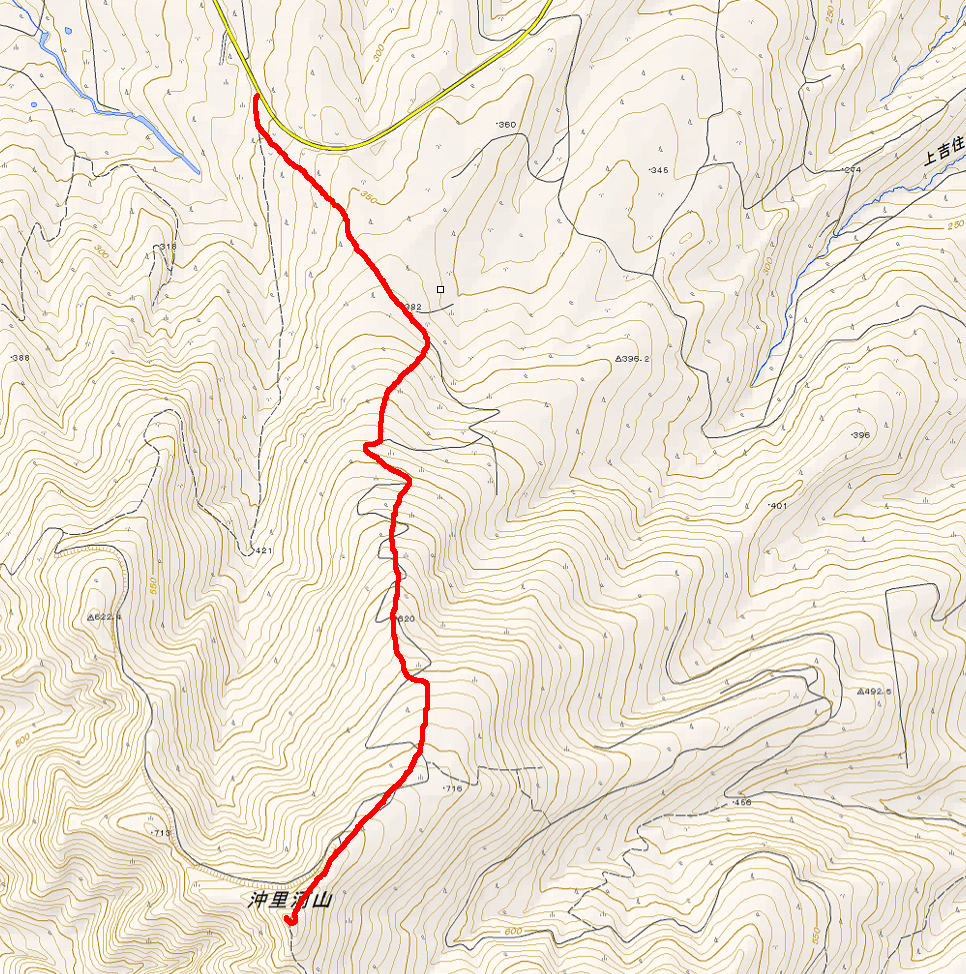
A couple of weeks ago I had to drop Sam off at an English camp in Fukagawa, so I decided to take the afternoon to climb a nearby mountain called Okirika-yama (沖里河山, 802 m). It’s one I’ve driven past any number of times on the way to Sapporo, but I’ve never bothered to check it out. I had just gotten my skis and skins a couple weeks earlier so I was eager to try them out.
Okirika-yama is one peak of a three-peaked massif south of National Route 12 in Fukagawa–the other two peaks are Otoe-yama (音江山, 795 m) and Irumukeppu-yama (イルムケップ山, 864 m). Like Kitoushi-yama, I’m pretty sure that Okirika-yama’s slopes were, or are, the site of a ski hill called Fukagawa Ski Field (深川スキー場)–although with nearby Kamui Ski Links I wouldn’t be surprised if they’d gone out of business. I didn’t see any evidence of chairlifts or lift towers, but it was evident from signs along the snowy slope and newly-planted trees that in the summertime this area gets some traffic. I think there’s a road that climbs the ski hill called Irumukeppu Skyline (イルムケップスカイライン).
Anyway, in the winter there’s nowhere to leave your car, but Prefectural Route 79 (the road closest to the ski hill and the one that the summertime Irumukeppu Skyline branches off of) is a fairly deserted road in the wintertime, so I pulled my car as close up to the snowbanks as possible and left it there. If I went back, I would probably excavate a little ways down the Irumukeppu Skyline road and leave the car there. Leaving my car on the road was a mistake.
There was a pretty length approach to the hill itself; what was more surprising was that there were big snowcat tracks along the road. Hmm. The tracks were a little crusty, so I imagined that they had probably been made a day or two earlier.
The snowcat tracks actually continued all the way up the ski hill-road (what I imagine is the Irumukeppu Skyline), crisscrossing in switchbacks as they climbed. When I got the opportunity I left the Skyline and started climbing through the powdery fields. I ran into some old snowshoe tracks, probably from a week previous or so, as well as that snowshoer’s ski tracks back down; a little higher up I also came across a ton of snowmobile tracks, a lot fresher. Now and again I could actually hear the snowmobiles, but they were on one of the neighboring peaks and I never actually saw the snowmobilers themselves.
As I climbed the ski hill I found myself mounting a big ridge; the climb was long but it was never really difficult. Near the top of the ridge it shallowed out pretty substantially and I had to start pushing myself. It was evidently the top of the ski hill, so I followed the snowmobile tracks into the forest closer to the summit.
The ridge narrows considerably near the summit and I found myself back on the road, and back in the tracks of the snowcat. Which was pretty remarkable, because the ridge’s flat top could barely have been wider than the snowcat itself. Soon I came to the end of the road, where there were a few signs covered in blue tarp. Snowmobile tracks and footprints headed into the woods at the end of the road, so I followed those. It wasn’t 50 meters before I came to the steep cone of the summit. One of the snowmobilers ahead of me had climbed up, postholing up to his groin, so I elected to leave the skis on and switchback my way up. The cone itself was maybe 10 meters tall so it was pretty short work.
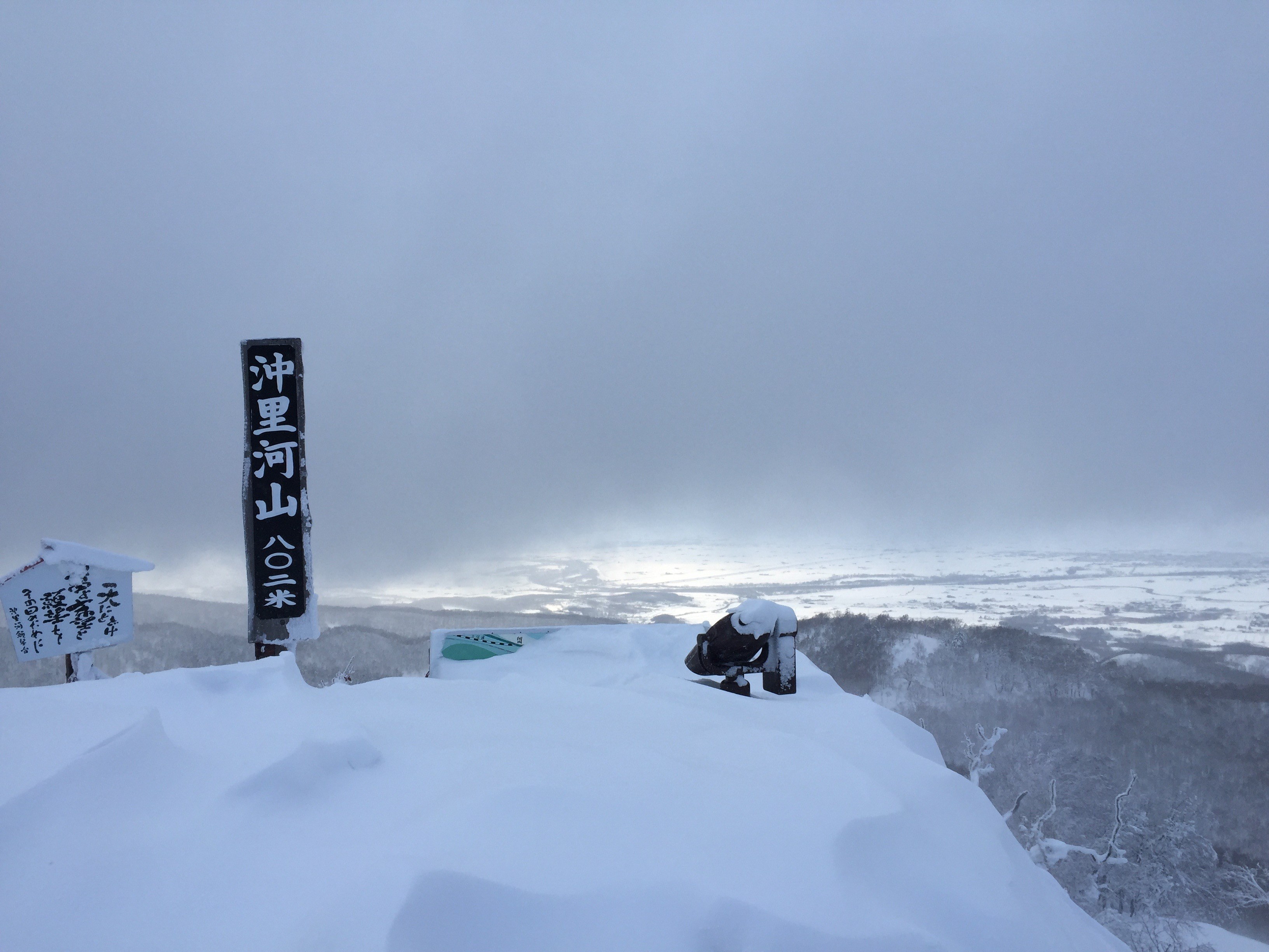
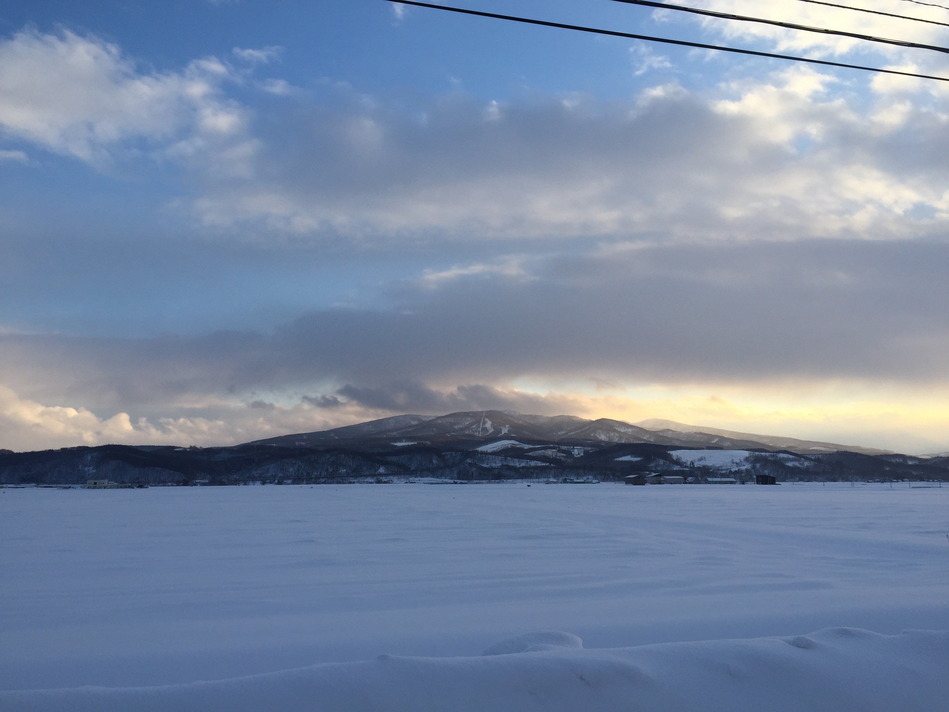
In the summer, the top of the mountain is capped by a little outlook platform, but in the winter it’s just a big cornice with the summit marker, a couple signs, and mounted binoculars sticking out of it. It was mostly clear and I got an amazing view over the huge Sorachi Plains below and back out towards Kamui Ski Links and Kamuikotan. On a clear day you’d probably be able to see down to the suburbs of Sapporo, looking south. I stopped for a little while and ate a Snickers, but it was pretty windy so I didn’t spend much time. I descended a bit, packed up my skins, and headed out.
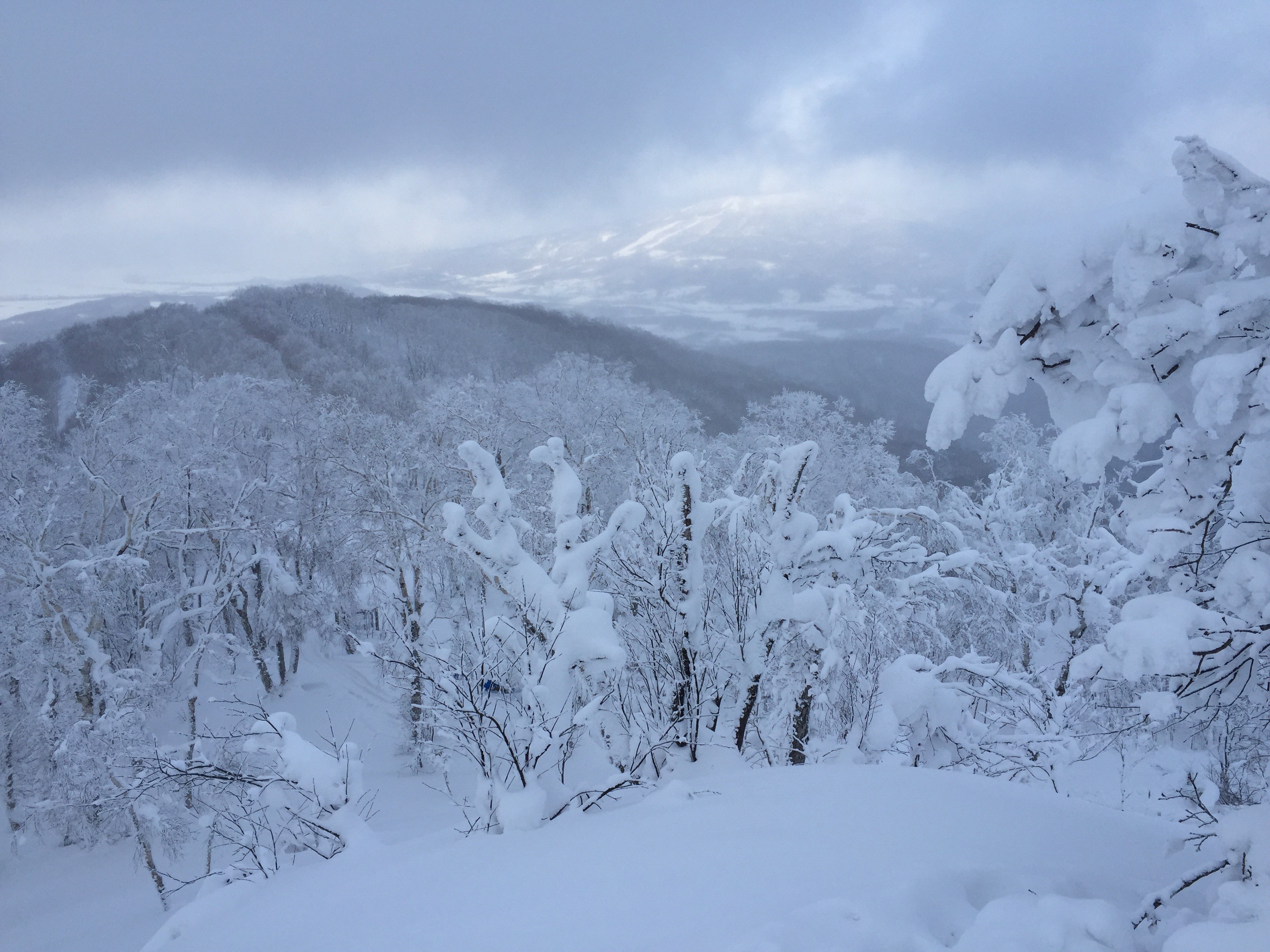
The upper slopes of the mountain were pretty flat so I wound up pushing myself along for quite a bit, but when I got back to the open terrain of the ski hill it was great going. The snow wasn’t particularly deep but a lack of tracks–especially lower down, where the snowmobilers hadn’t been–made up for it. It wasn’t fast skiing by any means but it was good fun. I found myself back at the bottom of the ski hill before I knew it.
It was a bit of a pain skiing out along the snowcat’s tracks, especially since they climbed a couple of short hills and I didn’t have skins on anymore. It wasn’t so troublesome that I would have put the skins back on, but I was getting a pretty blister (new boots) and I just wanted to be back at the car.
I had been a little worried that my car had been towed or ticketed or something–I had, after all, left it on the side of the road–but after the little climb from the trailhead back up to the road, I found it still there, safe and sound.
trailhead: 12:49 -> bottom of ski field: 13:07 -> summit: 14:23 -> bottom of ski field: 14:35 -> trailhead: 14:42
climbing time: 1 hour, 33 minutes / descending time: 18 minutes
Previous
How to climb Kitoushi-yama, a small hill just north of Asahikawa, in the wintertime.